HOW TO FIND US

With limited cell phone service, you may have trouble finding us.
Google Maps and Waze will take you directly to Devils Tower Lodge, but Apple Maps will not. 
Clink on the button below to download our map, and continue reading for step by step instructions. 
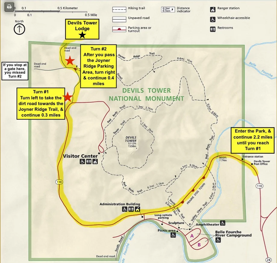
Map for Devils Tower Lodge

Turn #1
After entering Devils Tower National Monument, continue 2.2 miles, then turn left down a dirt road and head towards the Joyner Ridge Trail.
Continue for 0.3 miles.


Image may be subject to copyright

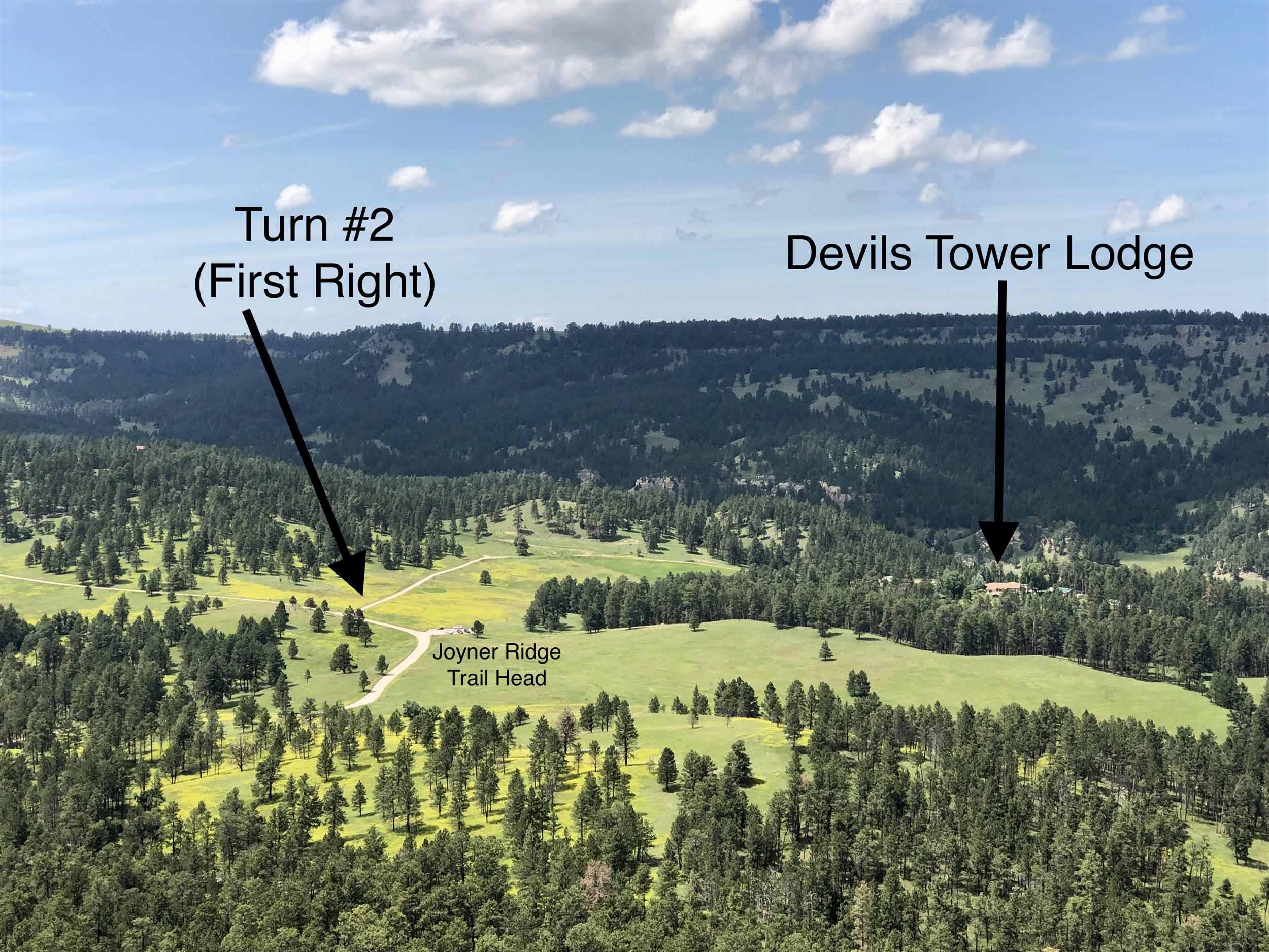
Turn #2
After you pass the parking area for the Joyner Ridge Trail, take the right turn immediately after. Follow that road about 0.4 miles until it ends at
Devils Tower Lodge.

(If you reach a gate, you missed this turn)


Turn #2